A day hike to Monte Resegone
by Monika Suchoszek
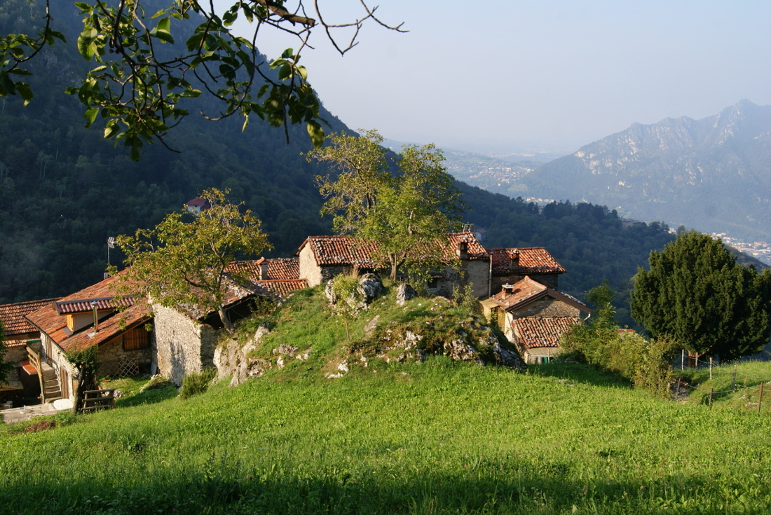
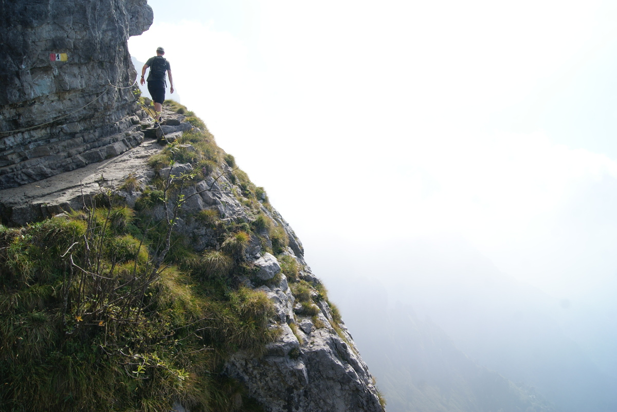
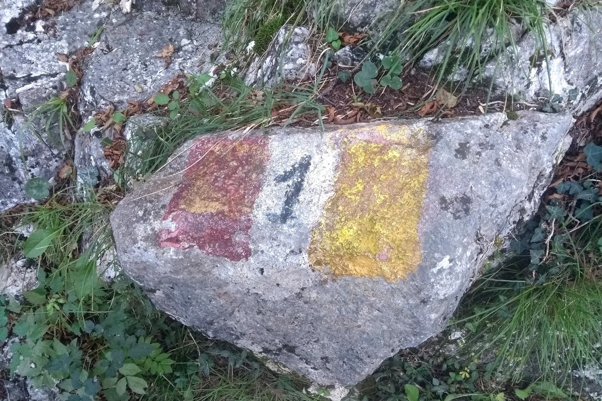
Lecco, a small city located on the southern tip of Lake Como turned out to be a fantastic base for hiking lovers. We could have actually stayed here longer than we did as we still had plenty of ideas for day hikes or just regular sightseeing. More about the city itself in the next post :) Our host in Lecco knew a lot about the mountains surrounding this region and suggested us two of the most demanding hikes and we enthousiastically followed her ideas :D The weather predictions were really good so we decided not to wait long and do the most demanding hike to Monte Resegone (1875m) the next day. It was not the distance which made this hike challenging but the altitude gain of around 1500m. We started the hike from the place where we stayed in Lecco (Acquate district) and we made our way up to hiking path number 1 which we followed to rifugio Luigi Azzoni near the peak of Monte Resegone. This path starts at the bottom of the cable car in Versasio and it first leads through the forest on a nice, wide,rocky path. Then it passes a small group of houses (Frazione Costa) and a shelter Rifugio Antonio Stoppani. From there we could already admire the stunning view of Como lake and Lecco city. The path was clearly marked with red-white-yellow stripes with number one written in the middle. Marks were placed on the rocks or trees, so no worries to get lost (of course you need to pay attendion on the crossings with other paths e.g. with MTB trails or paths leading to via ferratas).
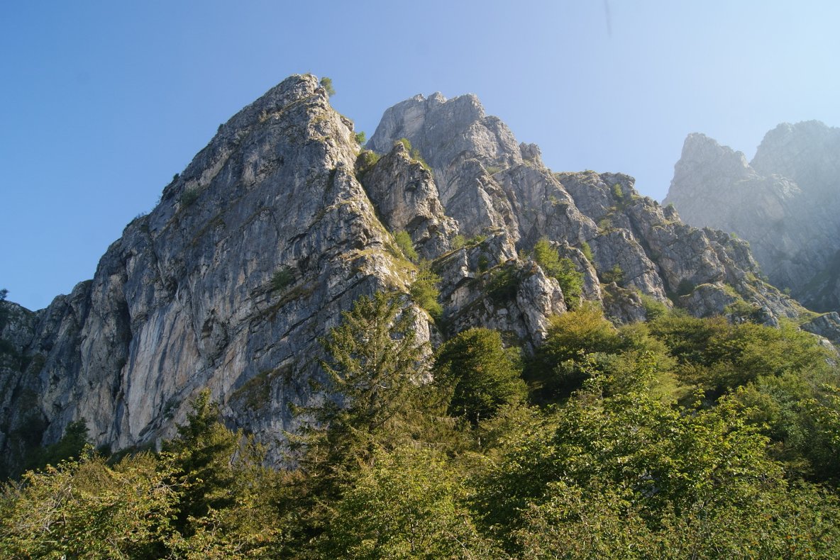
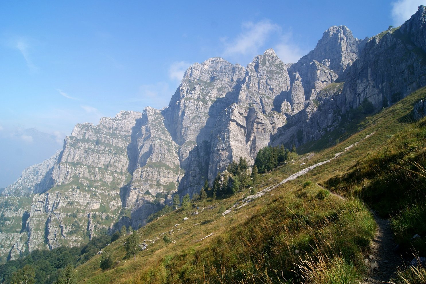
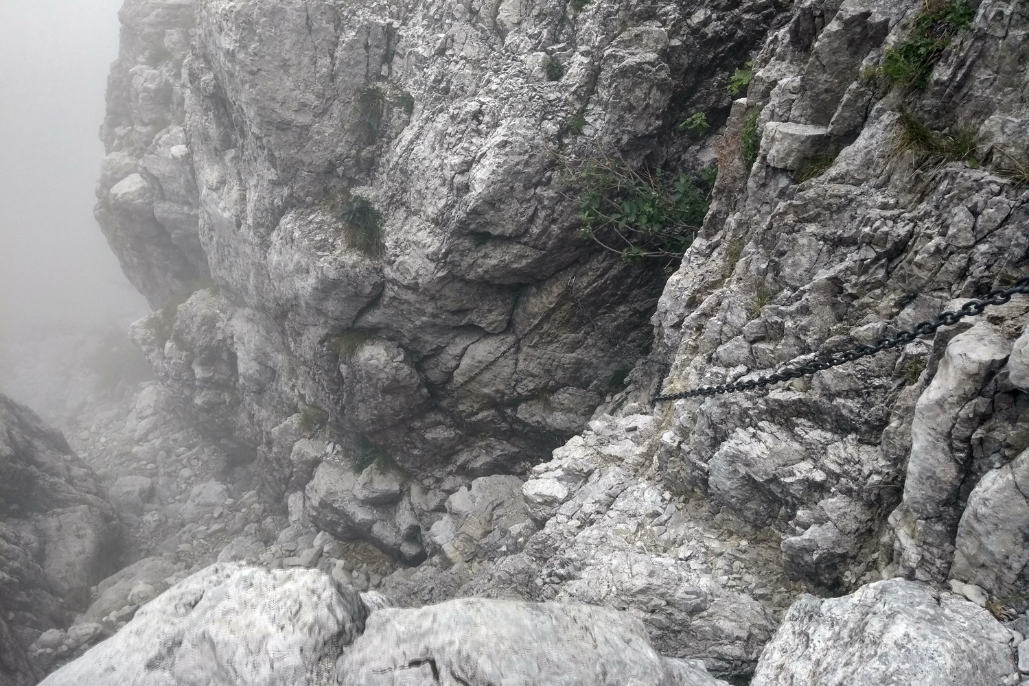
I was eager to reach the higher parts of the trail, above the tree-line and enjoy the impressive rock formations. I got super excited when I saw the first chains, that meant the path was about to get more interesting! :D In many places it was necessary to use hands, it was more like a scrambling than normal hike but these parts I just loved. Not everyone would be so excited (including my boyfriend) but I was climbing for 7 years so that part of me will always love the feeling of rocks and being in the exposed terrain. We had amazing weather but be aware that this path is difficult and many accidents happens there when it’s icy or rainy.
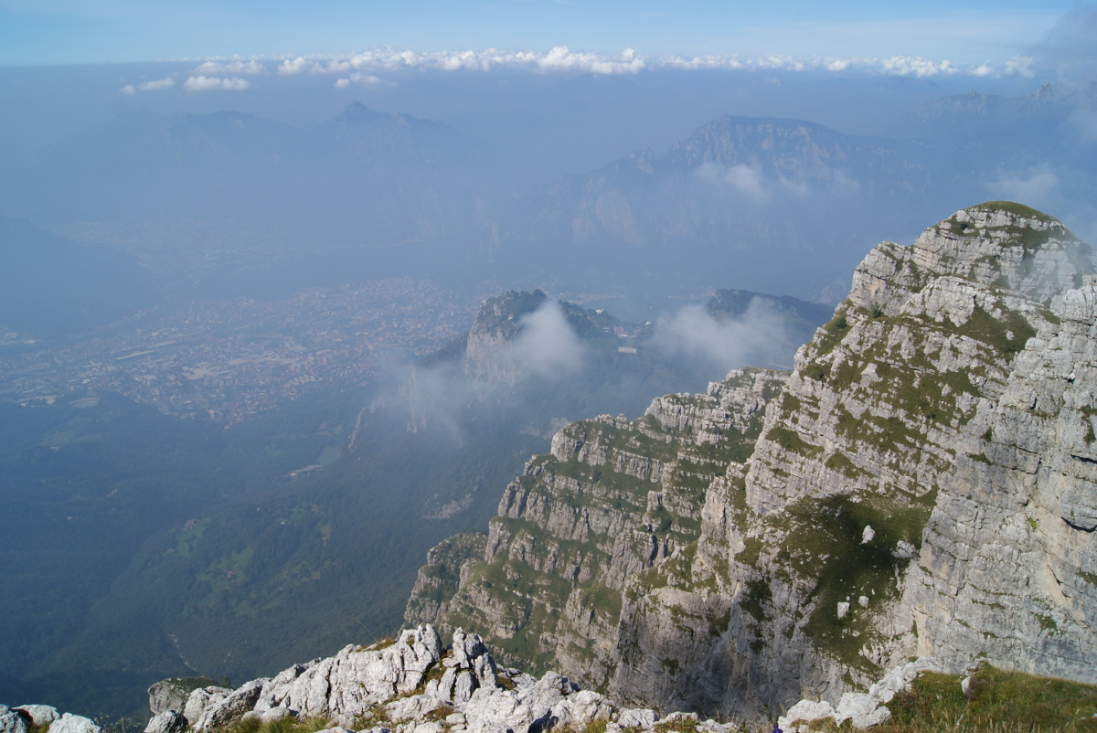
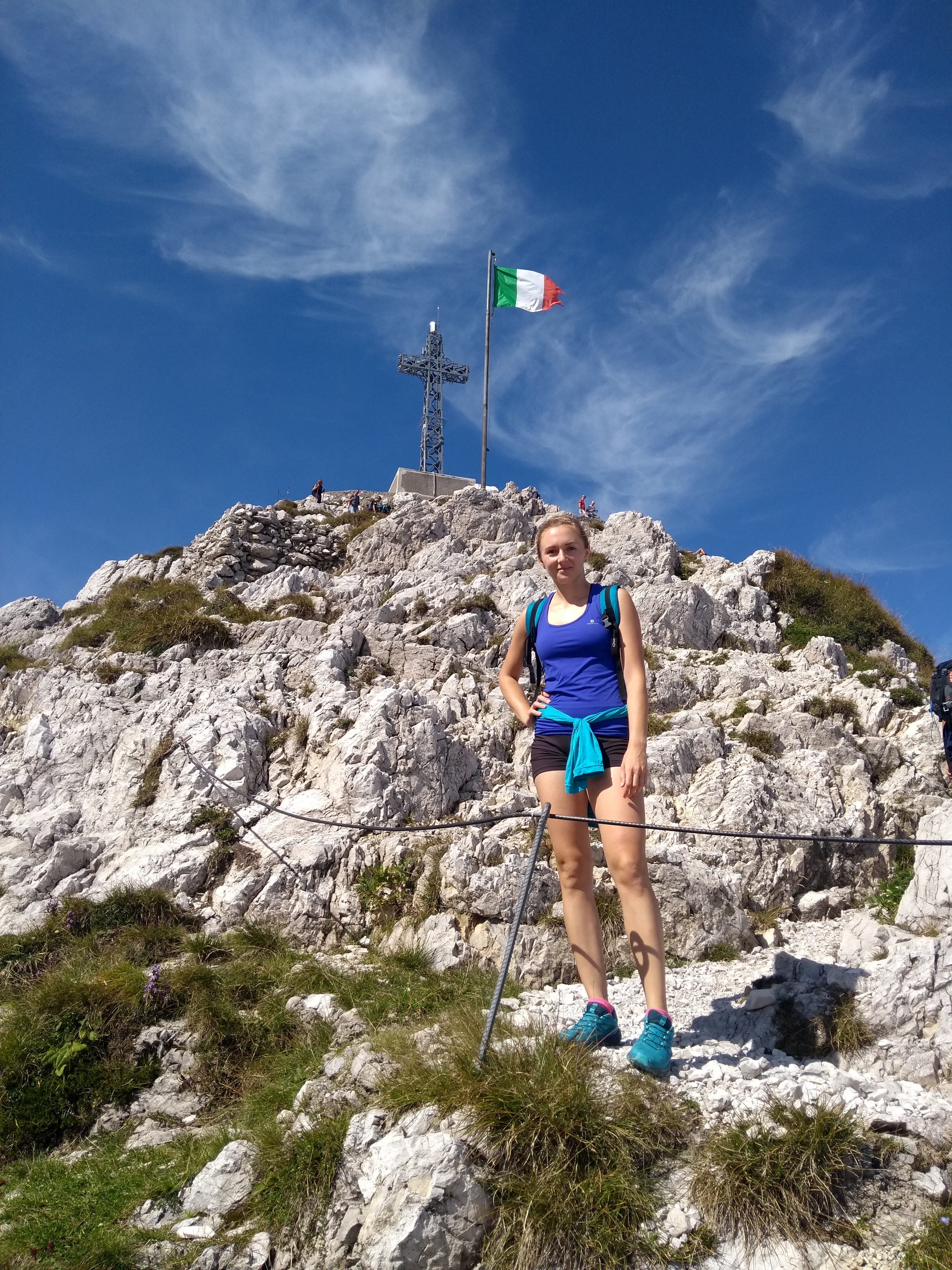
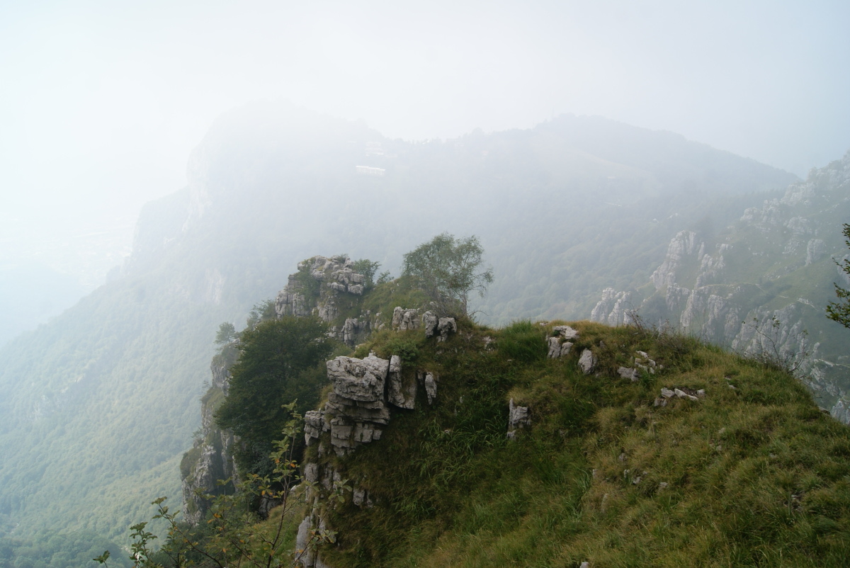
The view from the peak was really cool, mountains all around, when clouds moved out of the way we could see distant peaks and of course Como lake which, all together, create a spectacular experience! We stood there for a while admiring the mountain peaks. With over 30 peaks on the horizon, I found it really useful to look at the metal plate with points to all off them indicating their names and heights. There is a shelter next to the peak so you can grab some snacks, sandwich or even a simple hot meal.
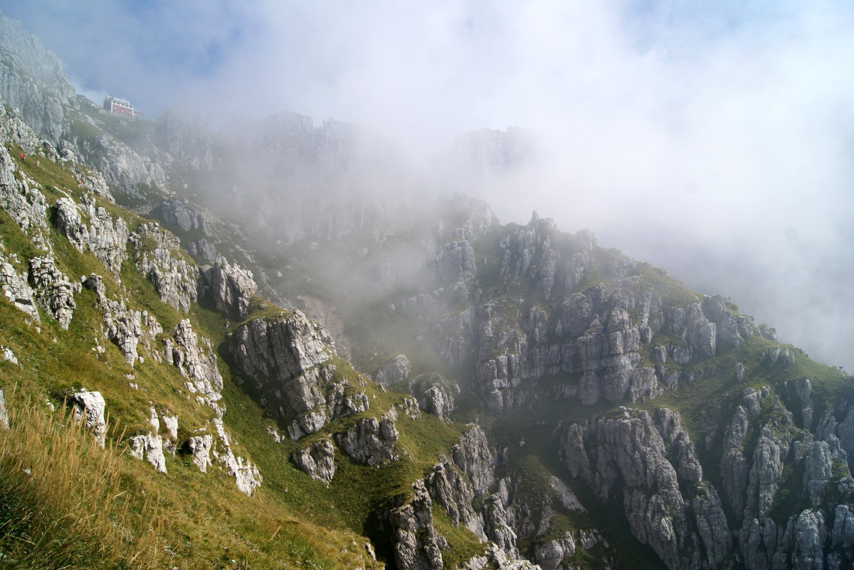
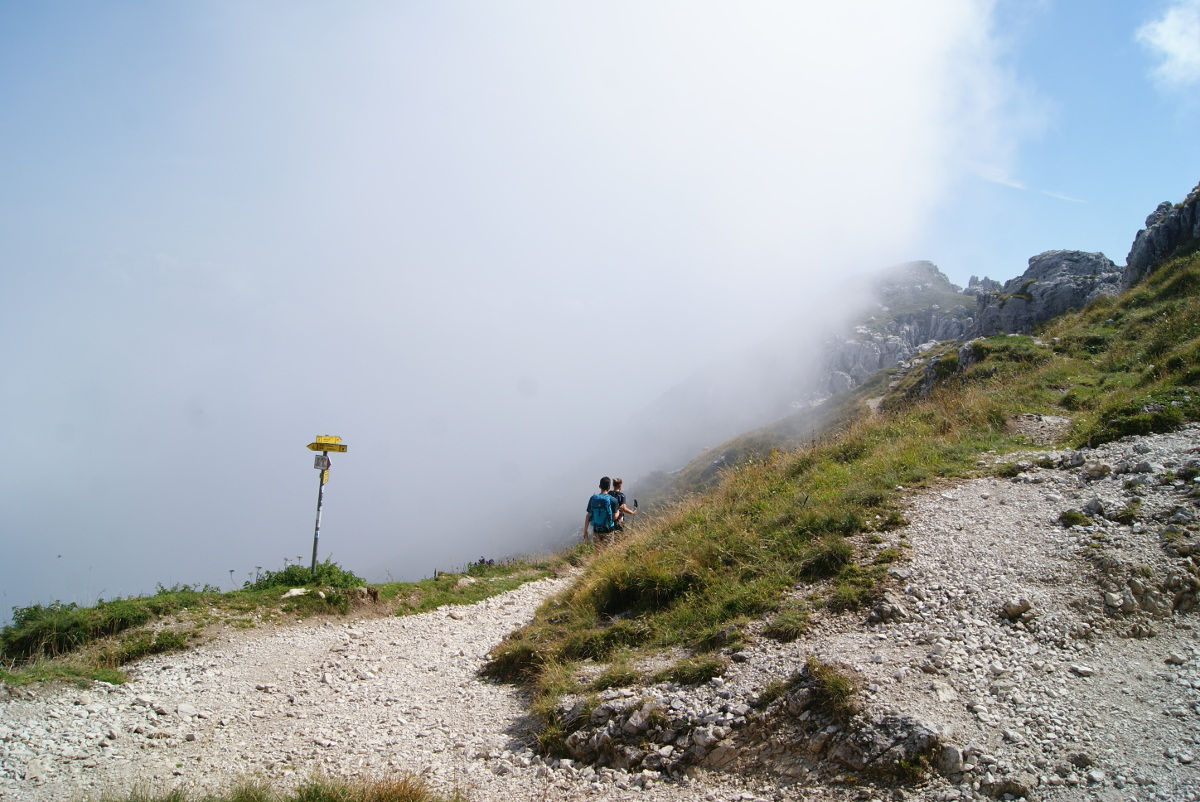
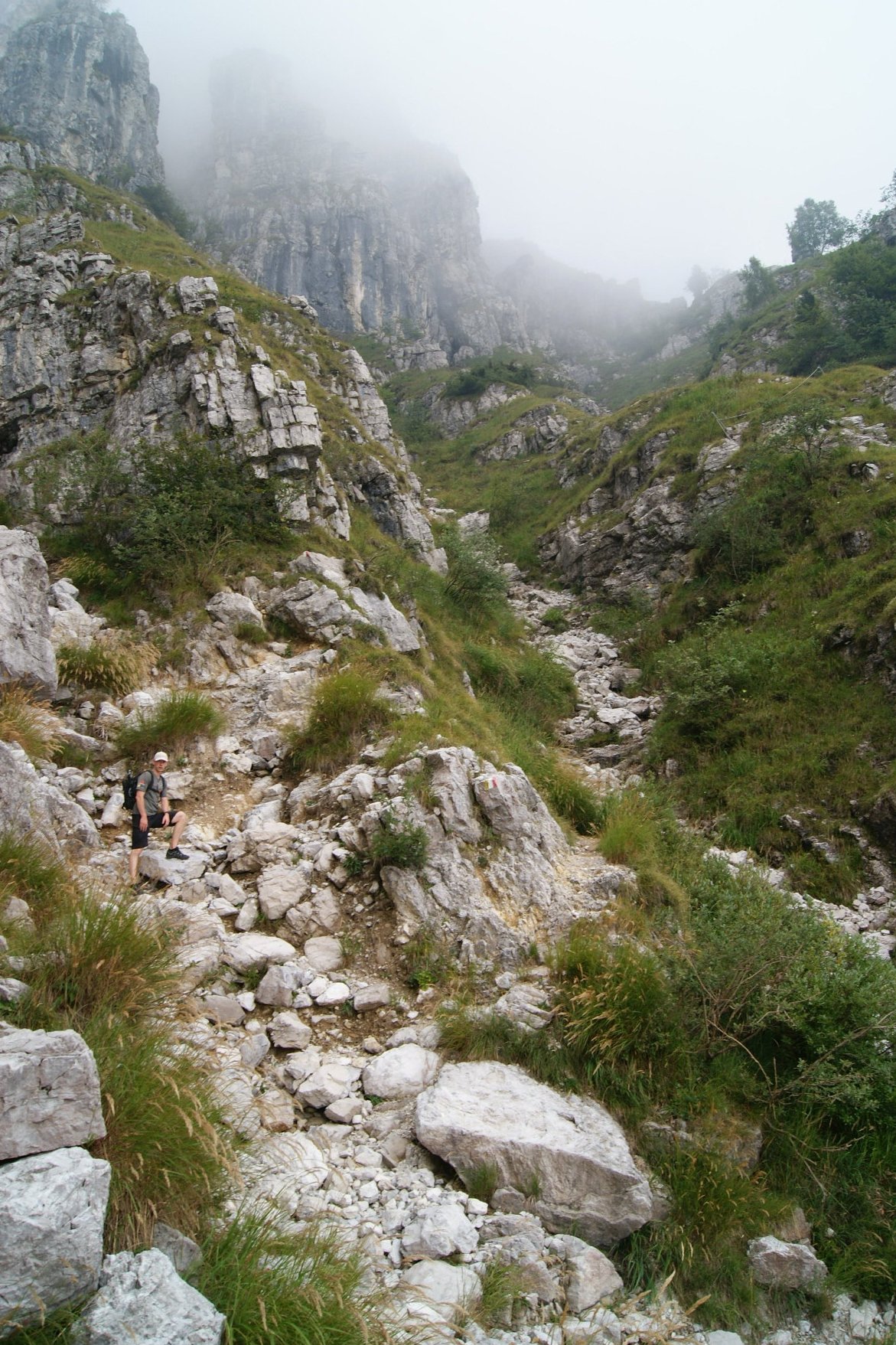
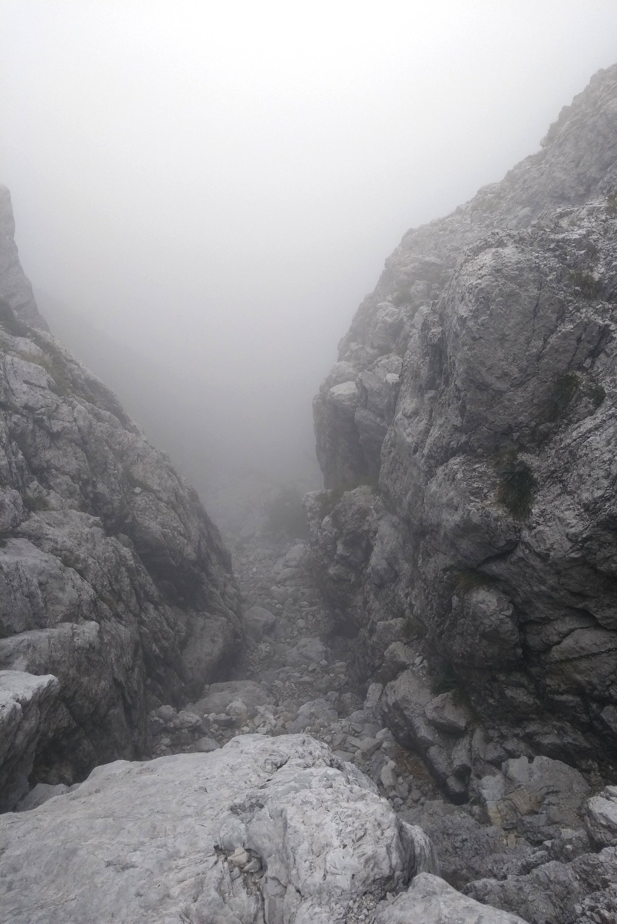
We decided to try another hiking path and go back to Piani d’Erna by trail number 10 (passing a few peaks, Punta Stoppani, Manzoni & Dente) which is less popular and unfortunately had way more loose rocks which actually makes it quite difficult to walk down as there was a high probability of falling down. Our muscles were constantly tense and got really tired after the first difficult part with some chains and falling rocks. Also, it got very foggy, the visibility was really low as shown on the photos below. If you really don’t like to do twice the same path then I would recommend to go up to the peak by the route number 10 and go down with number 1 which is still difficult but has less loosy rocks which are especially annoying while going down.
Practical info:
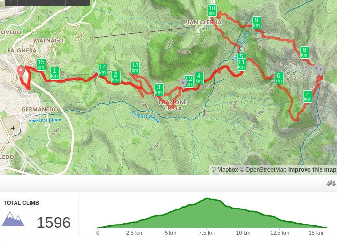
If you are afraid that this is gonna be too much for you but you still want to enjoy the spectacular views, then taking cable car to Piani d’Erna is a good idea. It will shorten the hike meaningfully, then it’s “only” about 550m of altitude gain to Monte Resegone. On the map below you can see our hike and the distance. It took us almost 4h to get there and almost the same (including breaks) to get back. We were not rushing, just enjoying the day. As always, navigation app MAPS.ME was very useful to double check our position and to find a shortcut to our room in Lecco. You can just simply download maps of the region where you stay for an offline use (maps of more than 100 countries in the world ready to download!). It worked even in Marocco when we did 10 days hike in Atlas Mountains where the paths were not really marked and difficult to find. We hightly reccomend this app for hiking but also for sightseeing. MAPS.ME app
The path was clearly marked with red-white-yellow colors and number one written in the middle. No worries to get lost, just look carefully for the marks on the rocks or trees. It is a popular destination for Italians and we met many of them on the hiking trail (or maybe it was crowded because it was Saturday). We did the hike in our trail running shoes (Salomon Speedcross 4 and Salomon SENSE RIDE) but high-cut hiking boots would be definitely recommended here. We are used to hike with lighter types of shoes and it works for us. Use gear you are comfortable with, this is not the place for experimentation ;-)
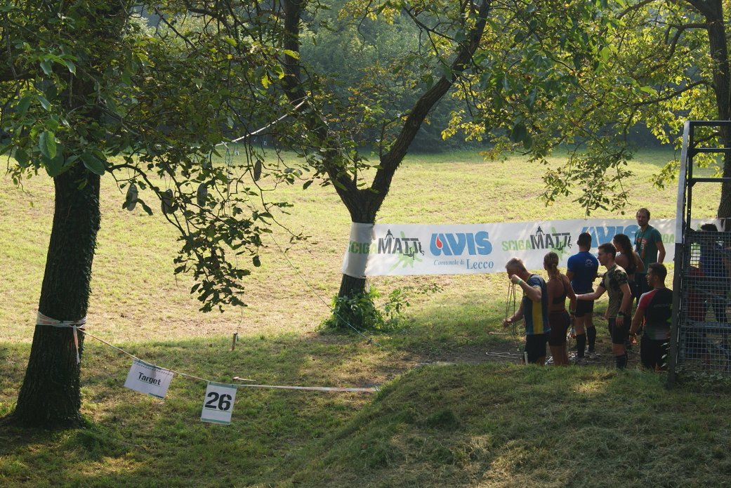
There were many activities happening in Lecco that weekend, besides the climate change meeting, there was an obstacle run which took place the day we went to Monte Resegone. On the way back we saw the participants struggeling to cross a big wall and climbing an obstacle with many ropes. We participated a few times in obstacle runs in Germany and Belgium and we highly recommend this kind of activity as a great adventure :) Check this link Scigamatt in Lecco in case you want to try something unusual during your next holidays.
Subscribe via RSS