Madeira Adventure: Day 4 - Pico Grande
by Monika Suchoszek
I was so excited about the day ahead! Pure hiking to one of the less touristy peaks on the island, and a vertical kilometer to do, that was the plan for today. The weather looked amazing, so we couldn’t have wished for more. With snacks packed for the day, we hit the road, ready for the adventure.
The first stop of the day was Miradouro da Eira do Serrado, which we reached shortly after 8 a.m. The first bus with tourists arrived at 8:30, just as we were leaving. There was only one other person at the viewpoint, it was a truly special experience to see the whole Nuns’ Valley (Curral das Freiras) nestled among steep mountains. It was absolutely stunning in the morning light. Pico Grande wasn’t visible due to clouds suspended above the peaks. We already noticed that most of the slopes were quite black, which only confirmed that the summer wildfires of August 2024 had left a significant impact on the local ecology. There is also a café, restaurant, and souvenir shop in hotel. It’s an easily accessible viewpoint, just a short walk from the free parking lot, located at an altitude of 1,095 m above sea level. There’s also a path starting at the viewpoint that leads to Curral das Freiras.
I know some people take a bus to this viewpoint from Funchal, do the hike, and return to Funchal from Curral das Freiras, which is possible, but you’d need to start the trip early in the morning. It seemed there were fewer bus connections in the afternoon. However, we did see people waiting at the bus stop when we had lunch in the early afternoon (bus 81), so there are buses, but you might need to wait a bit longer to get back to Funchal.
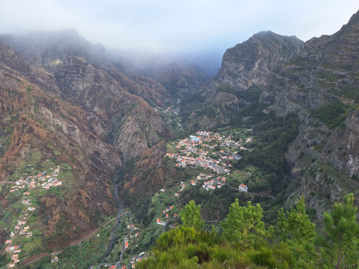
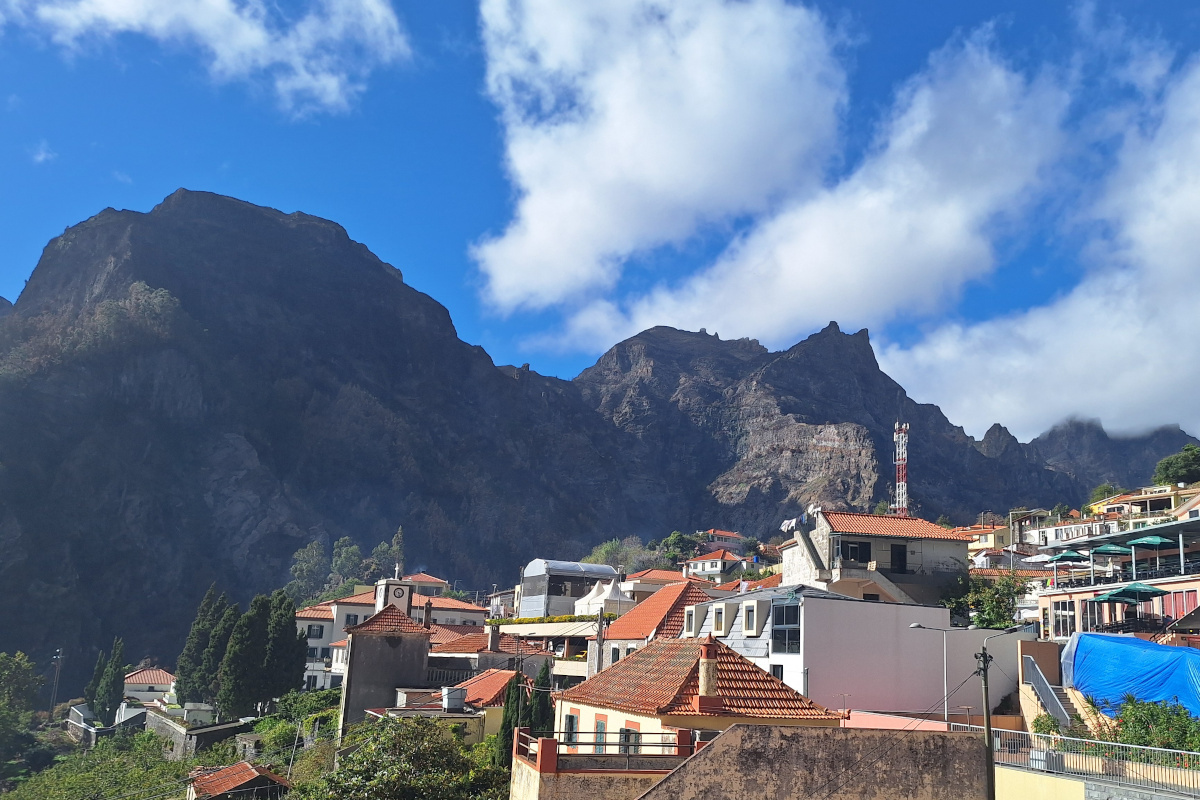
In the first photo below, the distant part of Curral das Freiras where we started the hike to Pico Grande is visible as the last group of houses at the top of the picture. In the middle, the main part of the village where we stopped after the hike for lunch and by accident found ourselves in the middle of the yearly Chestnut Festival! In the valley, you can taste local delicacies, including liqueurs in many flavors and various products based on edible chestnuts.
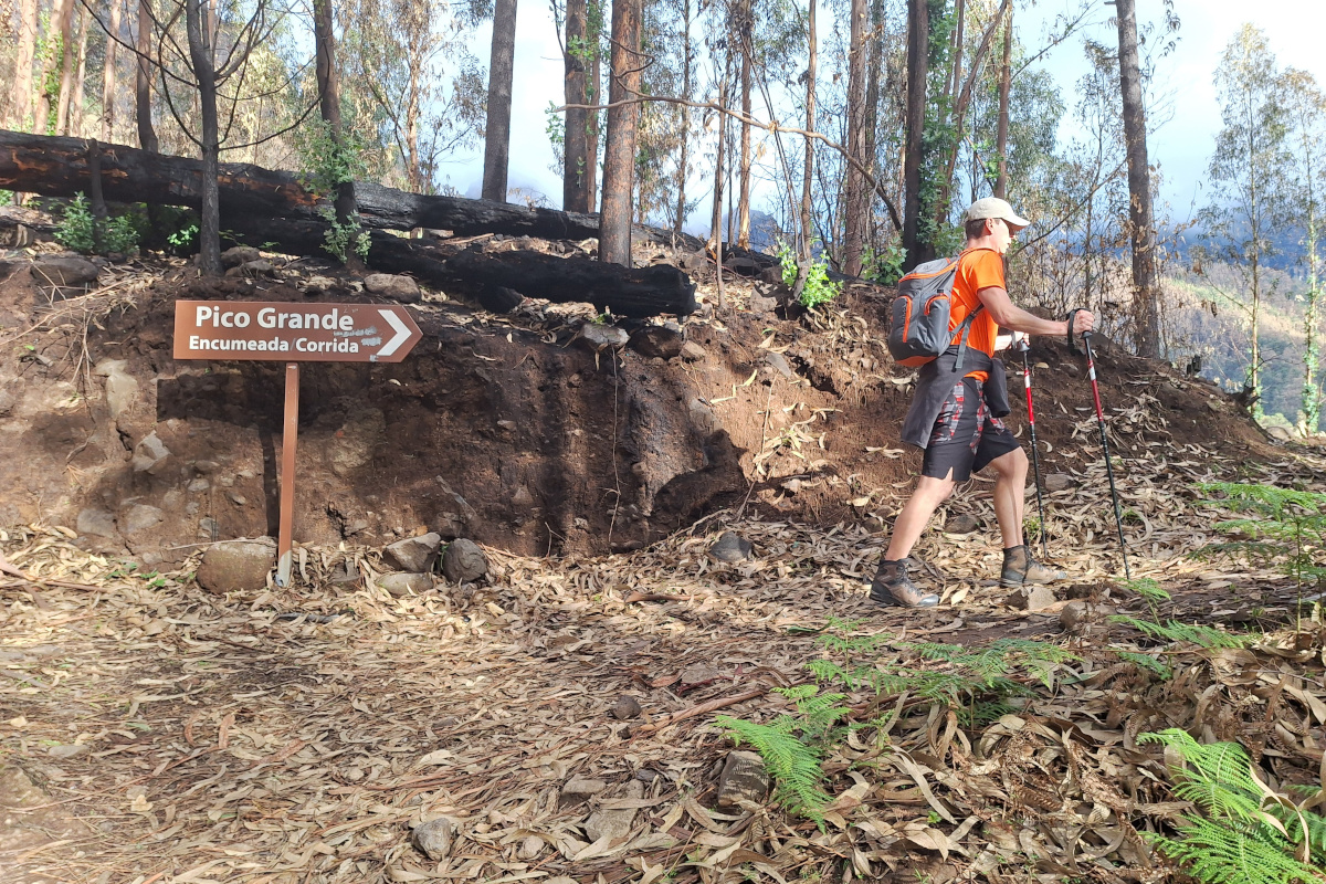
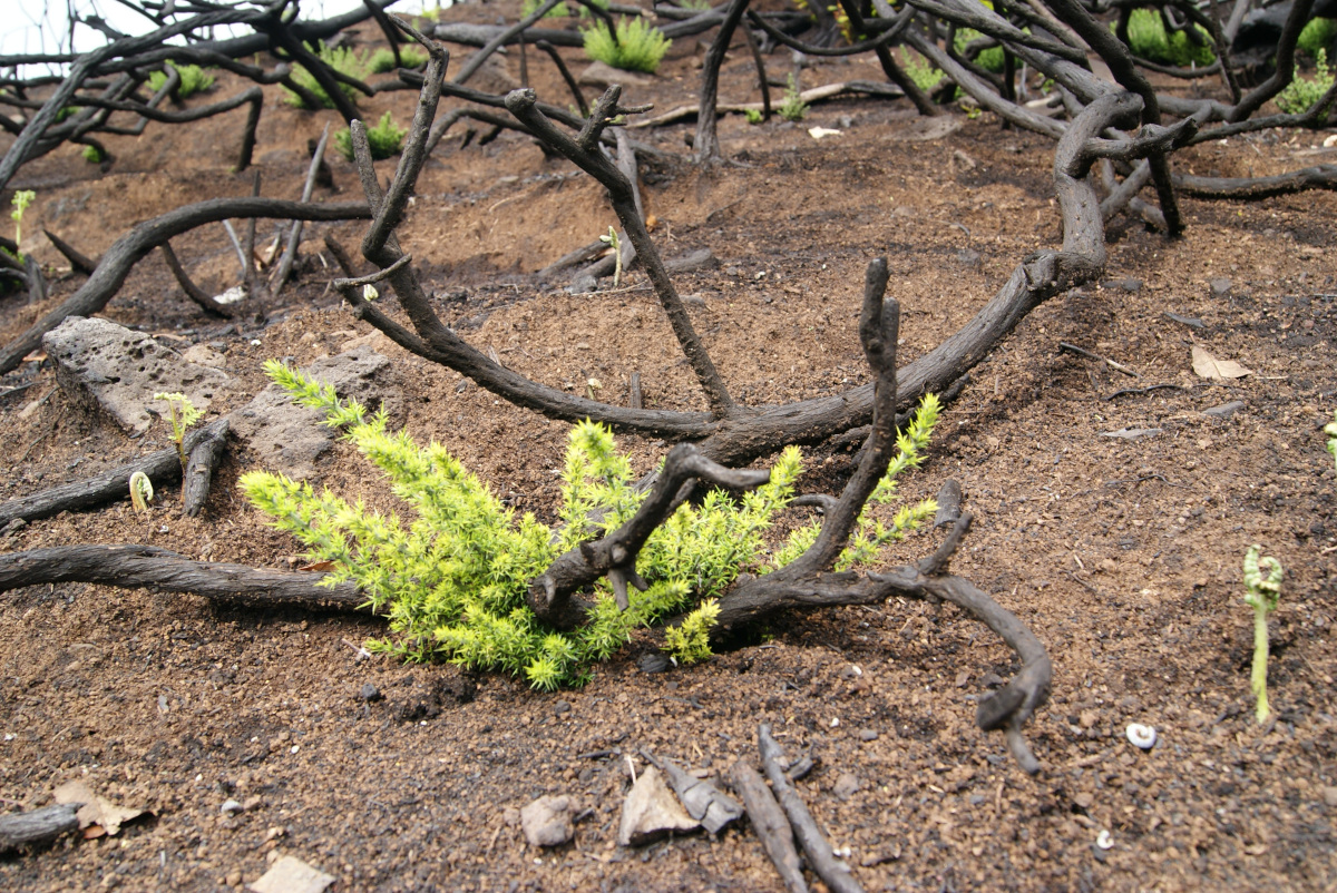
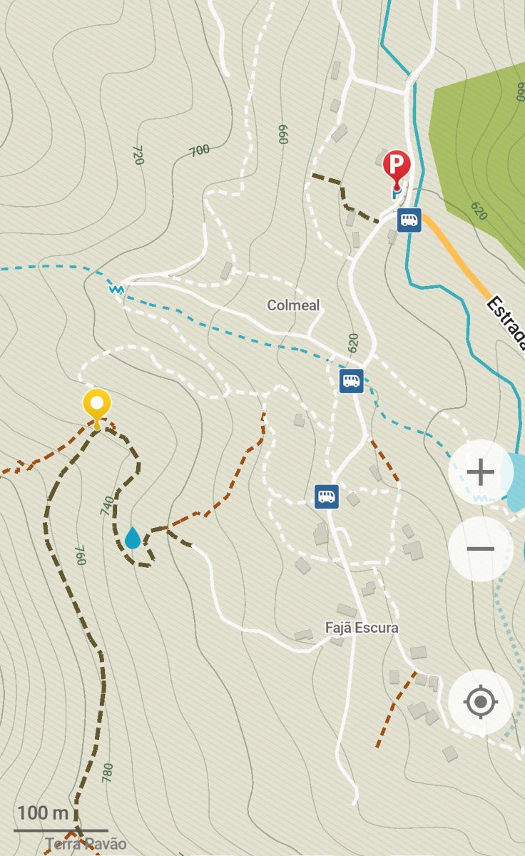
After a short drive to the furthest district of Curral das Freiras, we found the parking spot I had previously marked on Google Maps and were ready to start our hike. The first part led us through the village to Caminho de Fajã Escura à Revinha, the starting point of our route, where we noticed a wooden board pointing the way to Pico Grande. The trail began in a beautiful forest with tall trees, fallen leaves, and already visible signs of fire damage, burned trees (some large pieces on the path) and blackened soil. It was just three months after the wildfires, and nature was already beginning to recover, with young ferns emerging first.

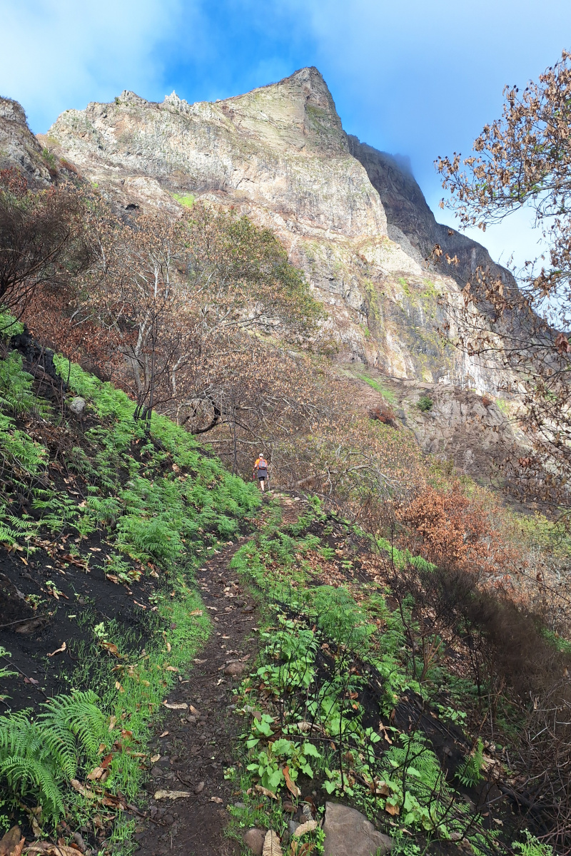
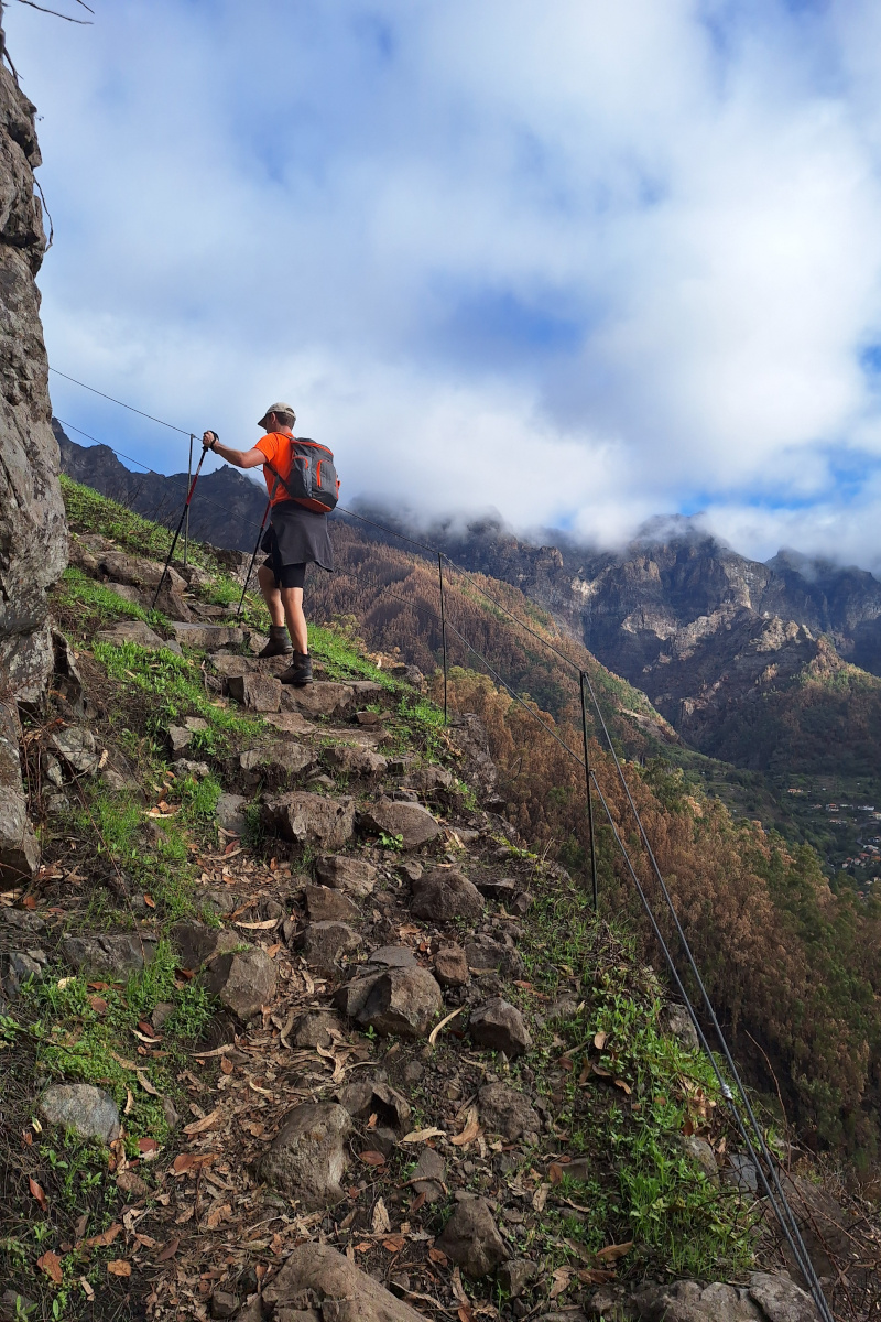
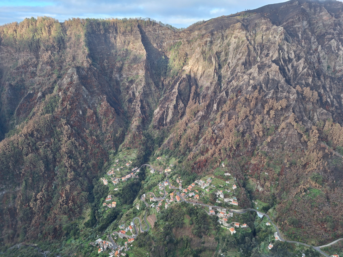
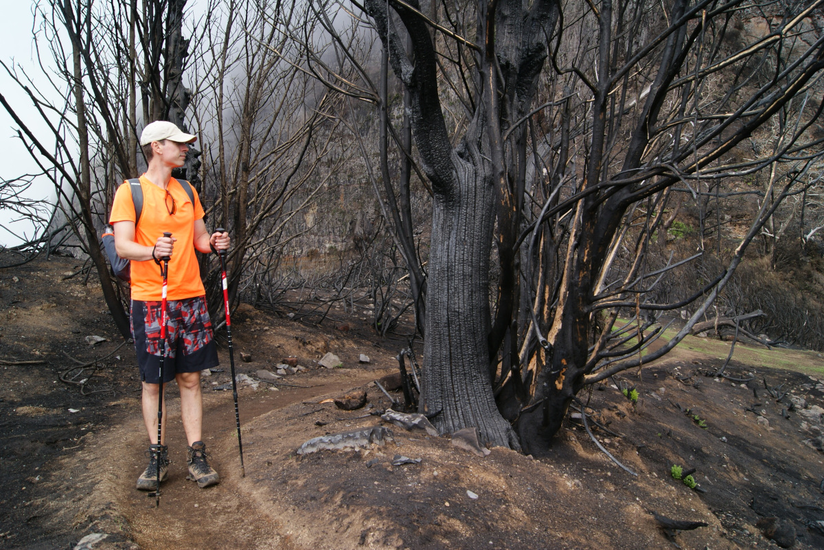
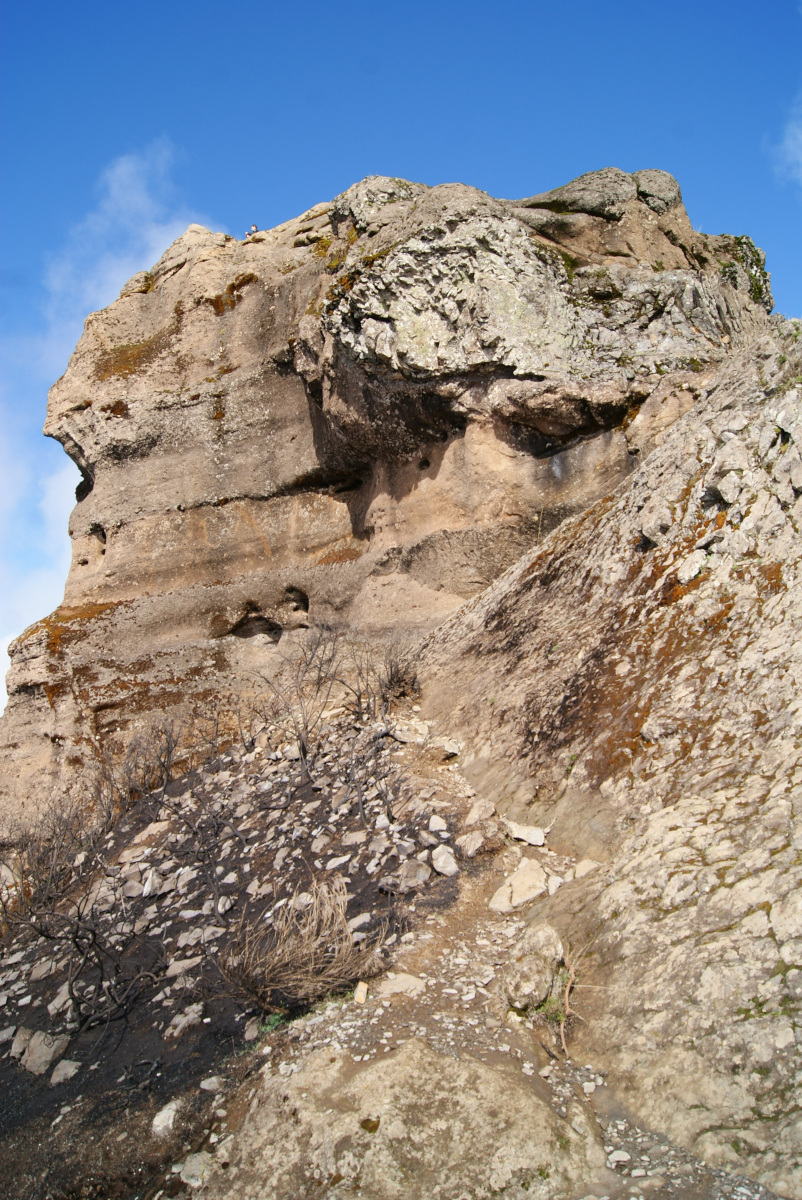
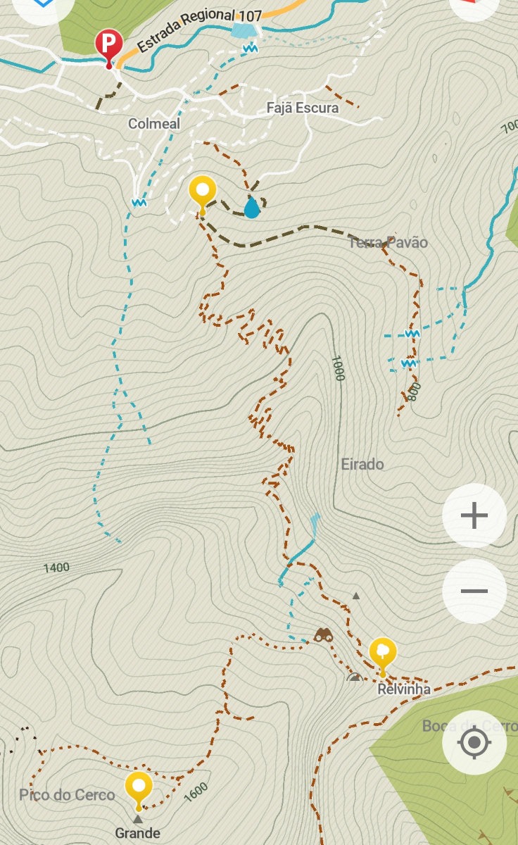
The path quickly became quite steep and, with fewer trees, more exposed. It was easy to follow and not technically difficult, but physically demanding. The terrain didn’t flatten until we reached the Relvinha viewing spot, where the Caminho Real da Encumeada Hike (PR12) passes by, though it’s not part of the hike to Pico Grande (visible in the middle photo below). Unfortunately, PR12 is still only partially open after the fires, only the first 3.5 km from the Boca da Corrida starting point, according to the official website. That would be up to Relvinha, based on organic maps. This was our first glimpse of the devastating impact of the fires. Black slopes, huge trees reduced to ashes. It was heartbreaking to see, and the smell of the burned landscape was still strong. The path from here became more technical, with some protection on the steep slopes, which were exposed and covered in loose rocks. Some parts were wet, despite the recent dry weather, so it might get really slippery on a rainy day. Up until this point, the trail had been very dry.
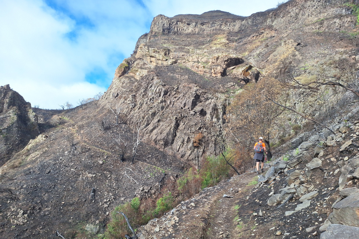
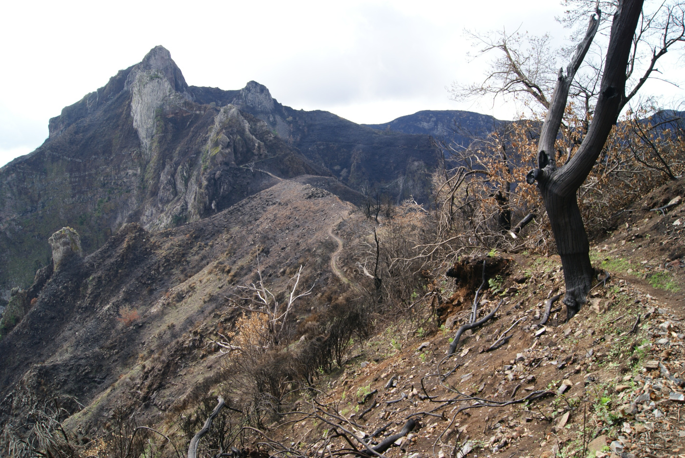
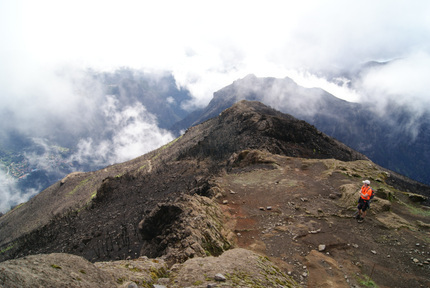
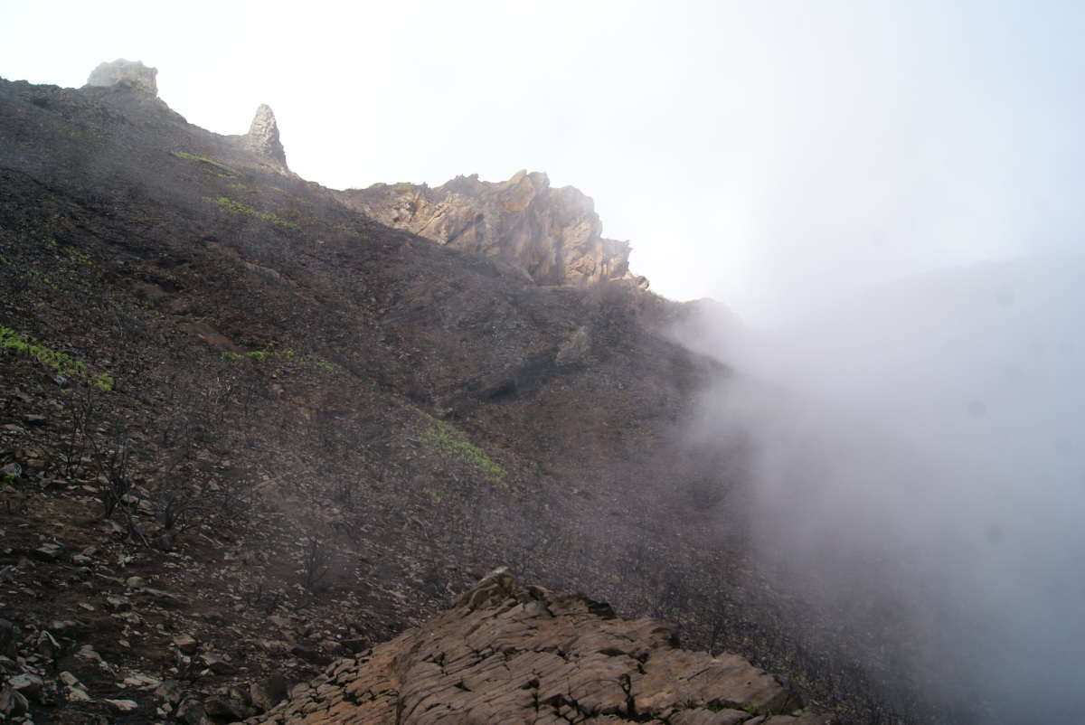
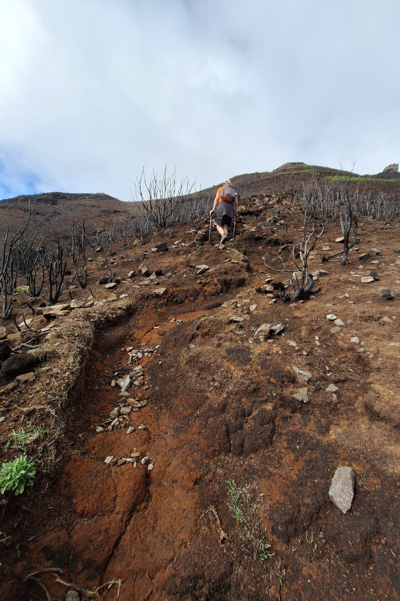
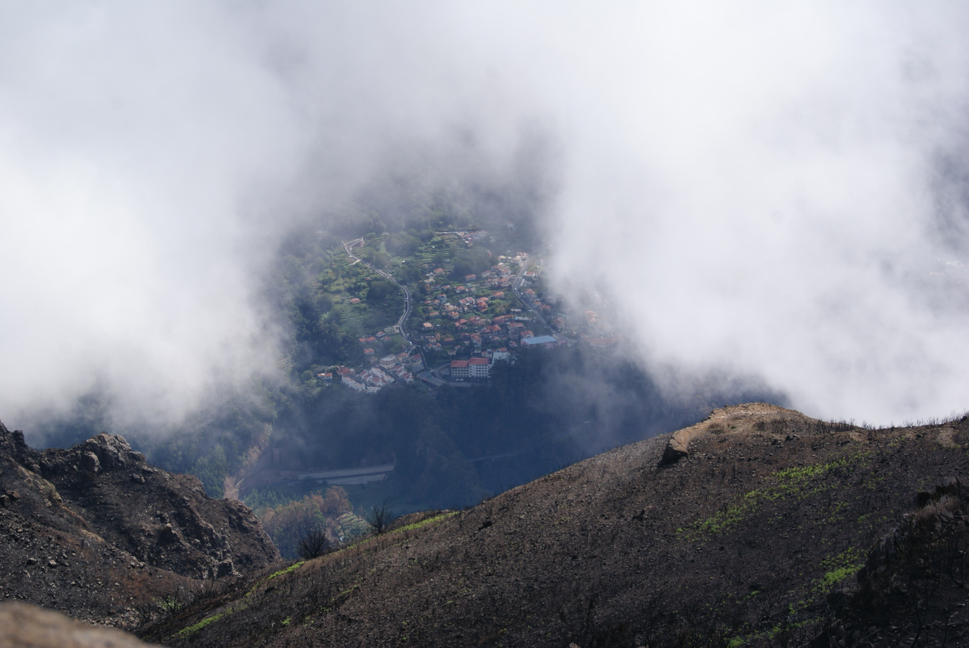
After traversing the steep slope, we reached a plateau where the path became less obvious. There were traces of multiple routes, but all led in the same direction. We checked our position on the phone, but from here we could already see the peak`s distinctive shape. The wind picked up and clouds started to pass quickly around us. We truly felt like we were on another planet. For brief moments, we were completely surrounded by mist and couldn’t see much, just the dark and red soil under our feet. Below is the view from the plateau near the peak, from where we could see the village near our starting point. The hike was incredibly steep, but absolutely worth it! The last part, to get to the peak itself is a bit unusual, you have to climb to get to the very top. It looks flat in the photo below, but it really isn’t. There was a rope to hold onto, and the exposure on the other side of the rock was impressive. In the end, it’s a bit sketchy, if you’re uncomfortable going up to the very top (like us), don’t (we didn’t either). But I still highly recommend this hike! In total, there were just under 15 people on the trail. Overall, on rainy days, the hike may be difficult and dangerous in places. Proper trekking shoes are definitely necessary.

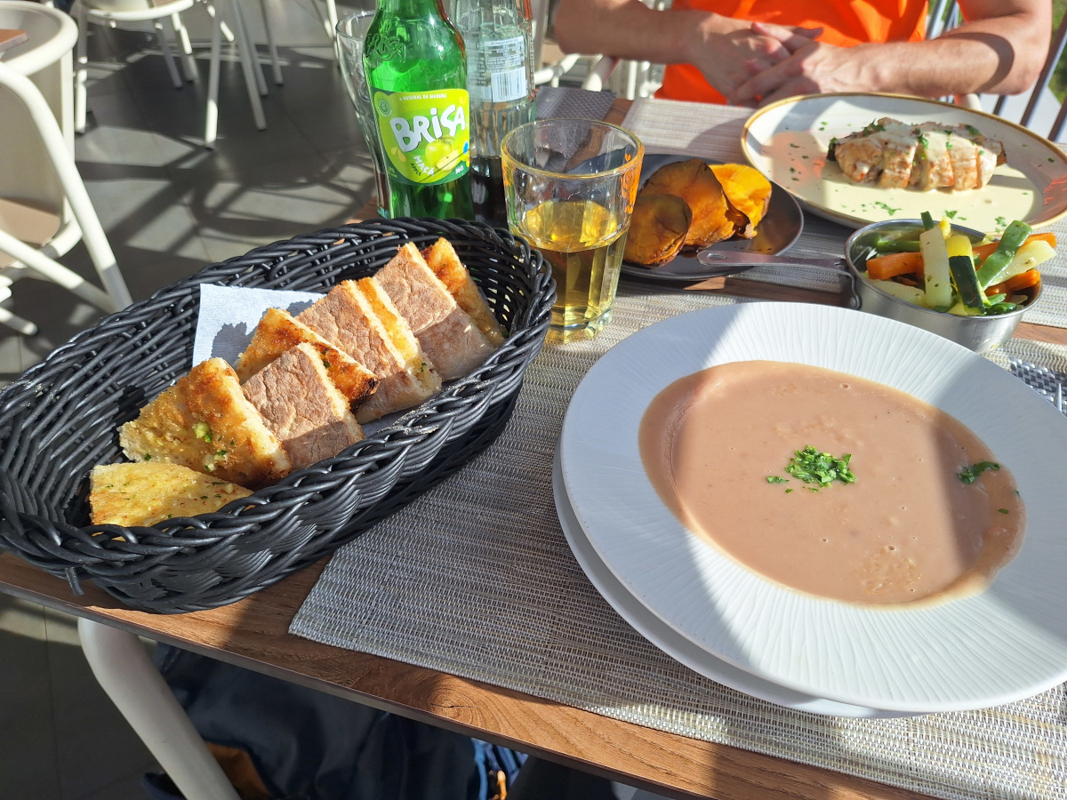
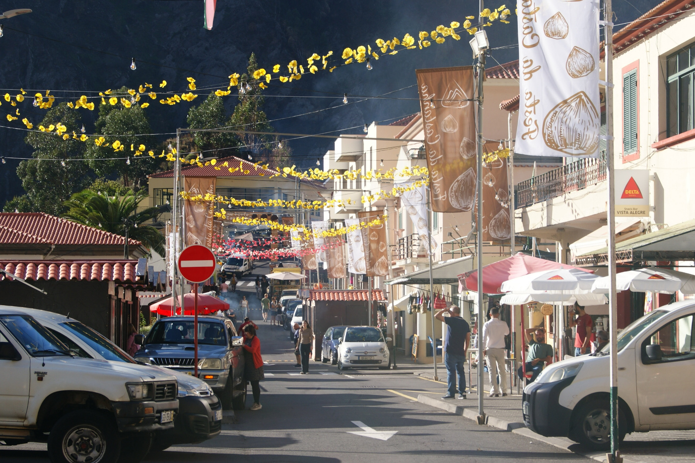
After the hike, we stopped in Curral das Freiras for lunch at a restaurant featuring edible chestnuts. We tried chestnut soup, meat with chestnut filling and sauce, incredibly good local sweet potatoes, traditional sweet potato bread (served with garlic butter), and grilled vegetables. The bread perfectly accompanied my soup. Simple, crispy on the outside, and fluffy and warm on the inside. From the restaurant’s terrace, we could clearly see Pico Grande, the clouds had completely disappeared, and the sky had opened up. This small village was still not overcrowded (it was early afternoon), but we had to park on the street, outside the central parking area, because there was a stage set up next to the church and food stands lining the main road. People were preparing for the annual Chestnut Festival (Festa da Castanha). It was a complete surprise for us, but such a great one! The festival takes place each year in Curral das Freiras, typically around November 1st.
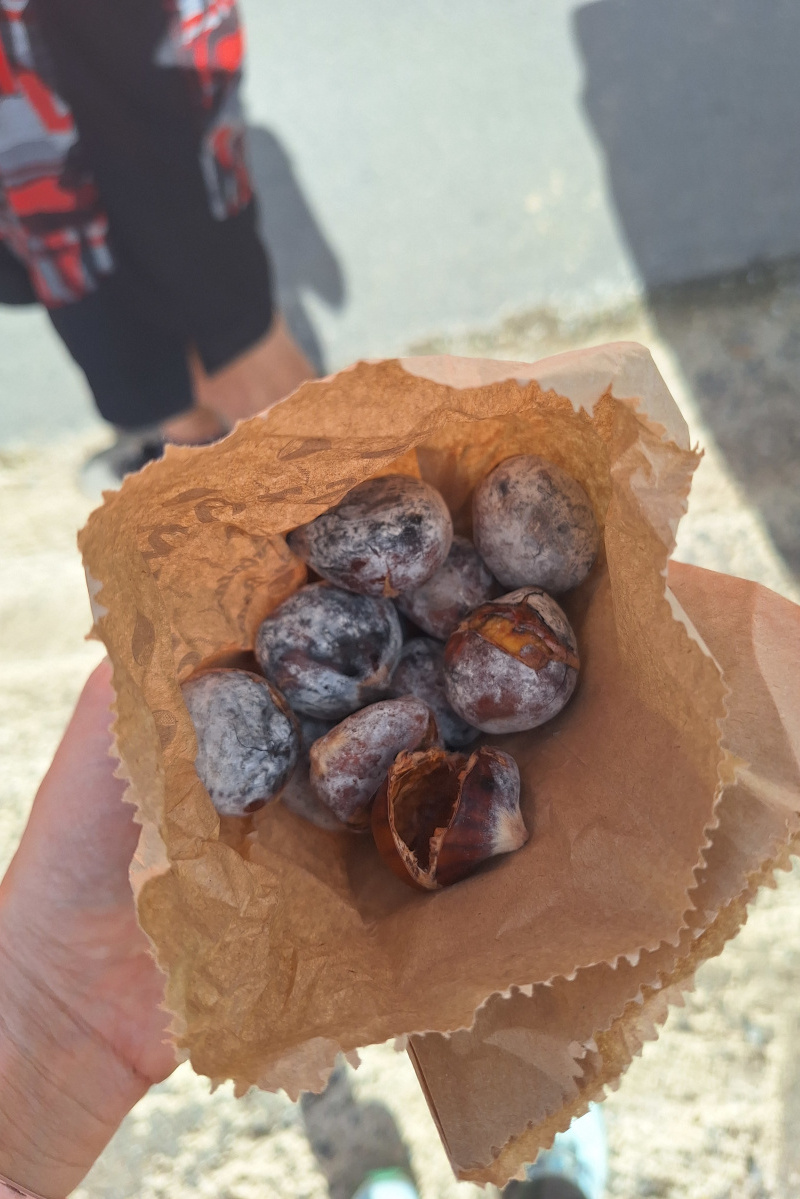
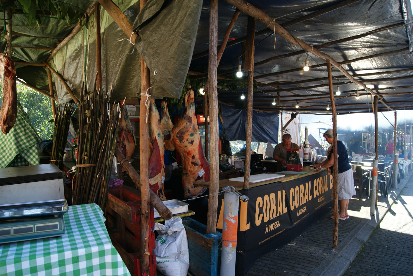
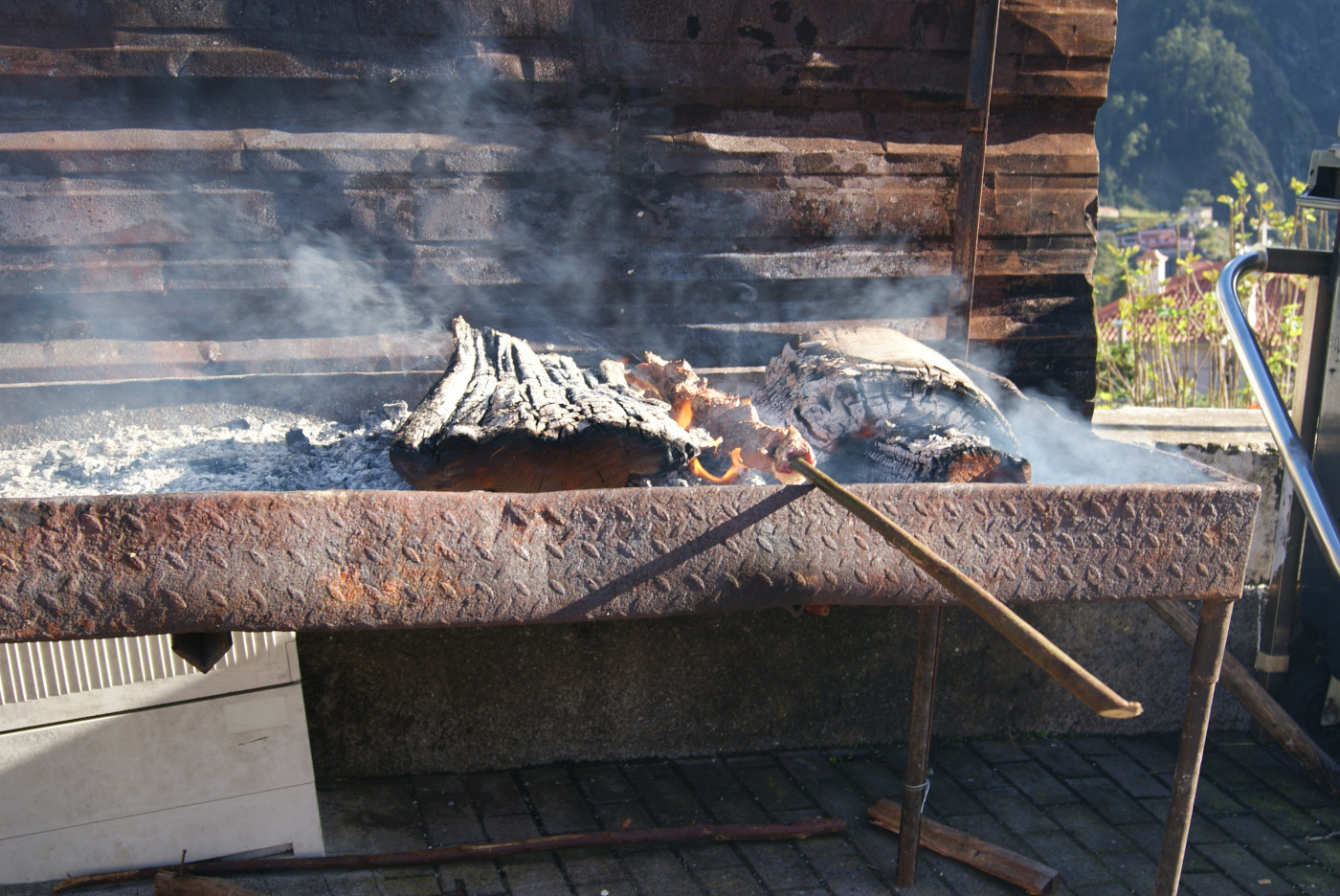
People were selling liqueurs, cakes, and other delicacies made from chestnuts. We also visited a local bakery to try some pastries, and then we noticed an evening event, the “Miss Castanha” (Chestnut Queen) contest, held as part of the festivities. We saw many food stands with whole pigs hanging in the back, barbecues, and stalls selling liqueurs, all just being set up, probably for the evening party. I also tried delicious chestnuts, roasted over an open fire. Roasted chestnuts are slightly sweet, with a texture somewhere between a soft cashew and very starchy, dense beans. I regret that we didn’t stay until the evening, but I was too scared of driving back to Funchal in the dark, as the road is not easy. It was a very pleasant village to stop in, full of souvenir shops, colorful decorations, and great food.

So far, it was the best day for me on Madeira, and almost the last one, as we had only one more day planned for Pico do Areeiro, the colorful village of Santana, and Calhau da Lapa beach.
Practical info:
-
Miradouro da Eira do Serrado - no entrance fee, very zigzag-y road last few kilometers.
-
Official website to check if hiking trails are open after the wildfires that occurred during the summer last year.
-
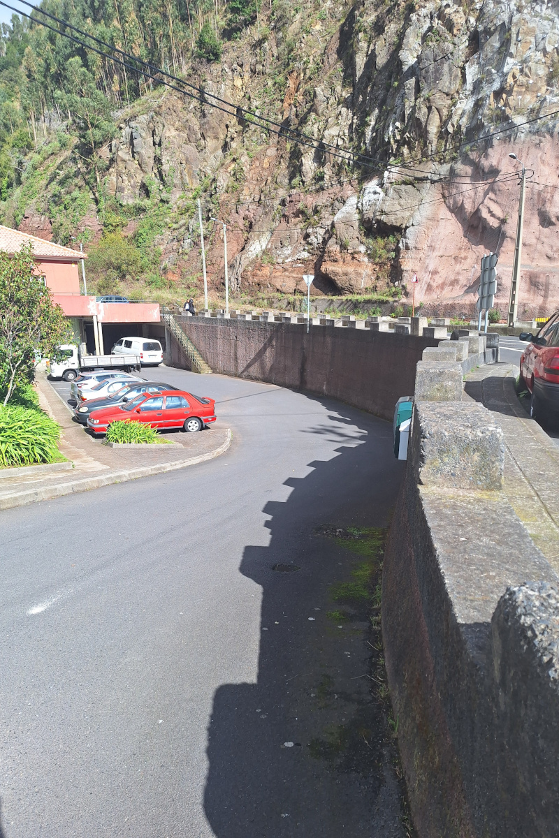
The starting point for the hike was at the end of Estrada do Colmeal, marked on Google Maps as Caminho de Fajã Escura à Revinha, where there is space for about two cars to park. Since we weren’t sure whether there would be any parking spots available, we left our car in a small parking area in the village (coordinates below) and walked from there. This parking lot is located below the main road, so it’s not visible from a distance ,it can accommodate around eight cars. While walking through the village, we noticed bus stops with the Bus 81 schedule posted. I even found it online line 81 but I couldn’t really understand when the bus goes to Fajã Escura-Final (CF19J), the bus stop we passed on the way.
Address of the parking: 32°44’08.5”N 16°58’09.6”W
Another stop to part (up to 5 cars, visible on street view): 32°43’55.6”N 16°58’14.9”W

- During our travels, we always use Organic Maps: Offline Hike, Bike, Trails, and Navigation app, which was very accurate on Madeira, we didn’t get lost even once. Our hike was 10km, 1000m up (we started at attitude of a bit more than 600m and finished at altitude of 1654 meters). It took almost 2 hours to reach the peak and 1.5h to get back (2h15min moving time of the whole activity), though total time was 5 hours as we took a few long breaks during the hike. The trail we did is described on official website as vertical kilometer because the difference in attitude between starting point and finish is slightly more than 1000m. I used Salewa Wildfire shoes and these were just perfect for this hike!

-
Chestnut Festival again this year: 31/10/2025 - 01/11/2025, stage with music and competition was set up next to Igreja Matriz do Curral das Freiras. The whole street Estr. Cónego Camacho was full of market stalls. Therefore, parking spots on this street were not available.
-
Restaurant - Sabores do Curral
Address: Caminho da Igreja N1, 9030-311 Curral das Freiras -
Bakery - Curral Das Freiras bakery & patisserie
Address: Estr. Cónego Camacho 33A, 9030-319 Curral das Freiras -
Parking: we parked along the street, maybe 5-minute walk from the church.
GPS Coordinates: 32°43’06.5”N 16°57’52.0”W
Subscribe via RSS